Satellites watch as bomb cyclone hits northeast U.S. with snow and lightning
Space.com
by Monisha Ravisetti February 23, 2026
AI-Generated Deep Dive Summary
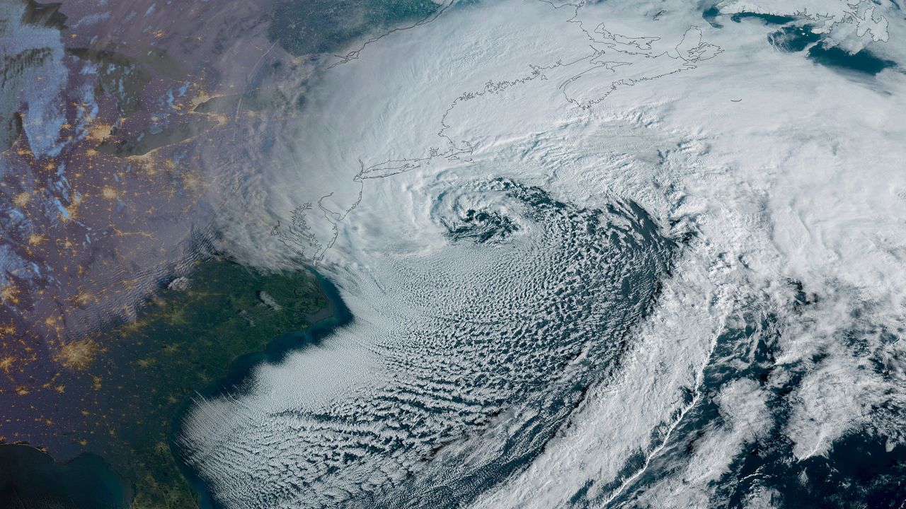
A bomb cyclone has brought severe winter weather to the northeast U.S., with satellite imagery capturing the intense storm's impact. The GOES East satellite provided stunning overhead views of the rapidly intensifying nor'easter, revealing its powerful winds and heavy snowfall across states like Massachusetts, New York, New Jersey, and Rhode Island. This "bomb cyclone" classification highlights the storm’s rapid strengthening, with wind speeds exceeding 84 mph in some areas. The storm has disrupted daily life, causing power outages for hundreds of thousands and travel bans in several regions.
Satellite data from NOAA and NASA’s GOES-R program revealed the storm’s evolution, including rare lightning flashes over snow—known as thundersnow—which occurred due to strong atmospheric instability and moisture levels. This phenomenon was observed by the GOES East satellite, which also captured images of the blizzard’s swirling pattern off the U.S. coast. The storm has dumped record amounts of snow in some areas, with Swansea, Massachusetts receiving over 26 inches and Newark, New Jersey accumulating nearly 18 inches of snow.
The situation is particularly notable for its scale, with nearly 60 million people under severe weather warnings. This marks the first blizzard warning for New York City in nine years, making it a historic event. Meteorologists are emphasizing the importance of satellite technology in monitoring such extreme weather events, as these images help scientists and officials track storm patterns and respond effectively to emergencies.
For readers interested in space, this highlights the critical role of meteorological satellites like GOES East in understanding and preparing for severe weather. These systems not only capture stunning visuals of natural disasters but also provide vital data for public safety during events like bomb cyclones. The ability to observe phenomena such as thundersnow from space underscores the intersection of science and technology in modern weather forecasting.
Verticals
spacescience
Originally published on Space.com on 2/23/2026